
I have taken umbrage at quite a few of this administration’s acts that have led to real harm to people.
People have lost jobs. People have lost rights and protections. People have been threatened physically. People have died.
So this whole renaming of a lake, even a Great one, seems like “no big deal.” And on the surface, it isn’t.
But as someone who spent a good chunk of my career working with authoritative geographic data, it hits deeply.
This is going to be a “nerdy” post about data. But it leads to a bigger point. So, please, stick with me.
SETTING BOUNDARIES
My last position in the US Government, before I was forced to resign, was as Senior Boundaries Analyst in the Office of Geography at the National Geospatial-Intelligence Agency (NGA).
In this role I oversaw the production and maintenance of the geospatial databases that contain every land and maritime boundary the US Government recognizes, and even ones the US doesn’t recognize but have been claimed by other nations.
My team and I reguarly scoured treaties, international law, public declarations by government officials, and national censuses. We then would produce highly accurate GIS data representations of international bounaries, internal administrative boundaries, maritime claims, and contested borders.
This data is used to inform everyone from senior policymakers, to intelligence analysts tracking world events, to officials making maps for conferences.
I also worked alongside NGA’s Geographic Names toponymists, who did much of the same research. Their mission is to ensure that the country, province, city, river, lake, gulf, and all other names in their databases accurately depicted what the places were called in reality and according to policy.
We interacted with the US Department of State on a regular basis, to ensure that the data we created matches official US policy. Any map produced by the government should accurately reflect the position of the United States.
For instance, in 2023, the United States officially declared the Extended Continental Shelf boundaries. This is the US asserting specific rights over the areas claimed. Releasing a series of maps showing these new boundaries communicated that change in policy to the world.
NGA takes the lead when it comes to foreign names and boundaries. That same task falls to the United States Geological Survey (USGS) for internal, domestic names and boundaries.
This mission is overseen by the Board on Geographic Names (BGN), who establishes and maintains uniform geographic name usage throughout the federal government, while NGA, the State Department, and the USGS provide the official datasets.
All that to say that a couple of recent headlines have really registered for me.
AIDS CONFERENCE EMBARRASSMENT
The first was a briefing at the AIDS 2026 conference in Rio de Janeiro, Brazil.
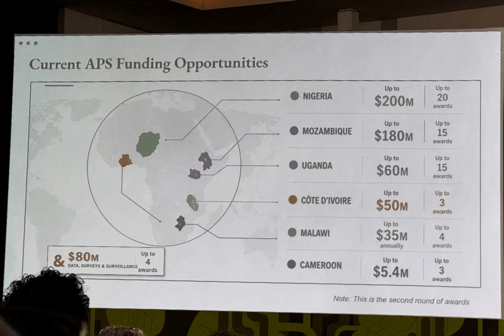
The US State Department, in front of the entire world, including representatives from the countries that appear on the slide, presented a completely incorrect “map” (I hesitate to use that word for whatever this is) of the African continent during their speech.
The State Department said it took “full responsibility” for the confusion caused and that the map had been produced by a team member who hastily changed the slide deck before the event …The map showed Nigeria, where the U.S. has several hundred troops deployed, as landlocked in the Sahara. Mozambique, which is in southeastern Africa, was relocated to the Horn of Africa, while Ivory Coast in West Africa was placed on the other side of the continent.
I personally know that the State Department has the data to make this map correctly, because I physically created some of it myself and oversaw the production and distribution of all the data.
The foreign aid cuts by DOGE have literally resulted in hundreds of thousands of deaths. So again, is a botched map that big of a deal? Probably not in the grand scheme of things.
But, this incident reflects a disturbing willingness of this administration to treat basic facts and authoritative information without the care to accuracy and honesty deserved.
LAKE AMERICA?!
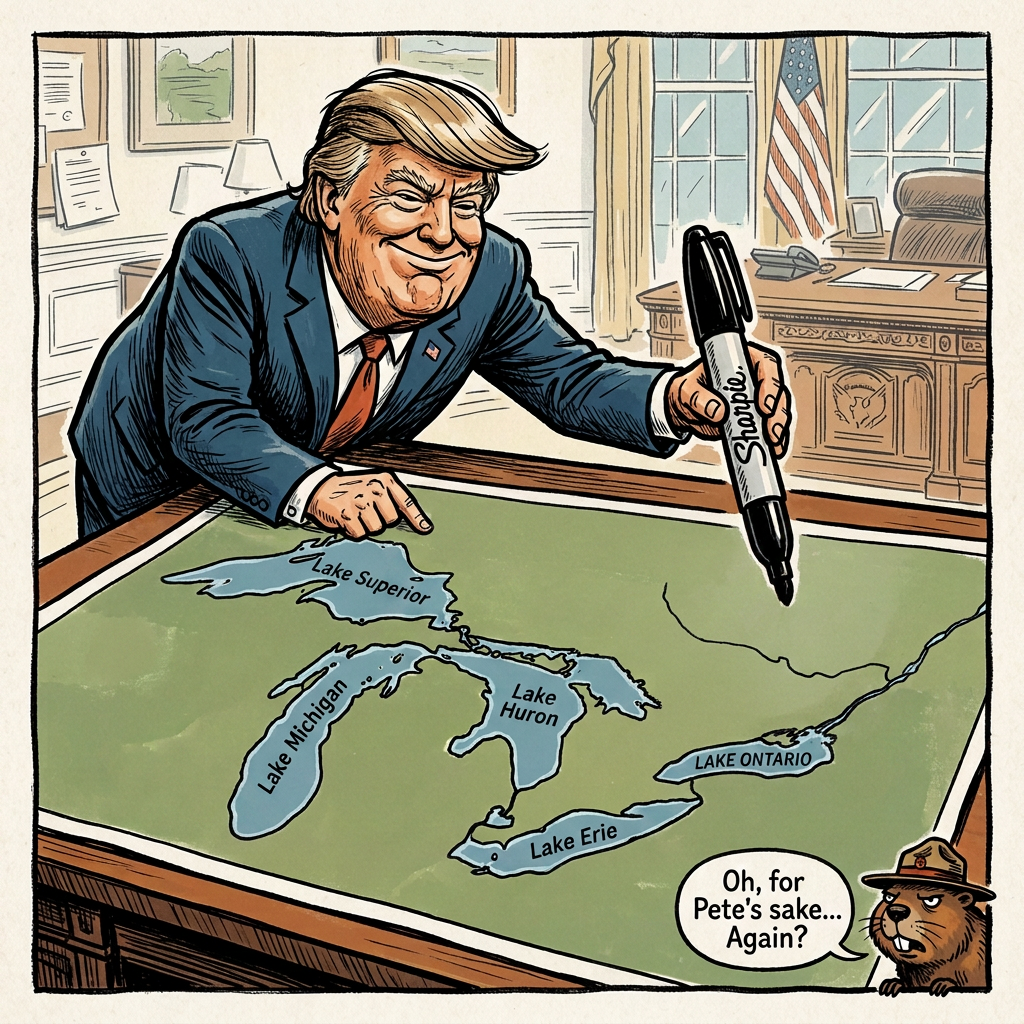
Now we get the latest geographical headline. This week, Donald Trump signed an Executive Order renaming Lake Ontario as Lake America.
My first response is to laugh at the idiocy. Seriously? He did what? Again?
However, I know what is happening, or has likely already happened, at my old office.
Rest in peace, Tim Curry 😢
One of the last acts my office handled before I resigned involved changing the Gulf of Mexico to the Gulf of America. In that executive order, Trump even hinted at replacing members of the BGN if they didn’t acquiesce to his demands. People who I knew personally and worked with on a regular basis had their jobs threatened by Executive Order.
It’s important to remember that an EO can only affect what the US officially calls the lake in our databases, not what Canada and the rest of the world call it.
Therefore, recently, an NGA Boundaries Analyst had to open the dataset and find the US/Canada boundary inside Lake Ontario. Then they had to divide the lake into two polygons, one attributed as Lake Ontario and one attributed Lake America.
Meanwhile, an NGA Geographic Names toponymist had to replace the “approved name” of the lake as Lake America and relegate Lake Ontario to be just a variant. According to NGA’s data dictionary:
- Approved (N)- The BGN board-approved local official name for a geographic feature. Except for countries with more than one official language; there is normally only one such name for a feature wholly within a country.
- Variant (V) – A former name, name in local usage, or other spelling found on various sources.
Taking a look at the NGA Geographic Names Search Application to see if that has been enacted:
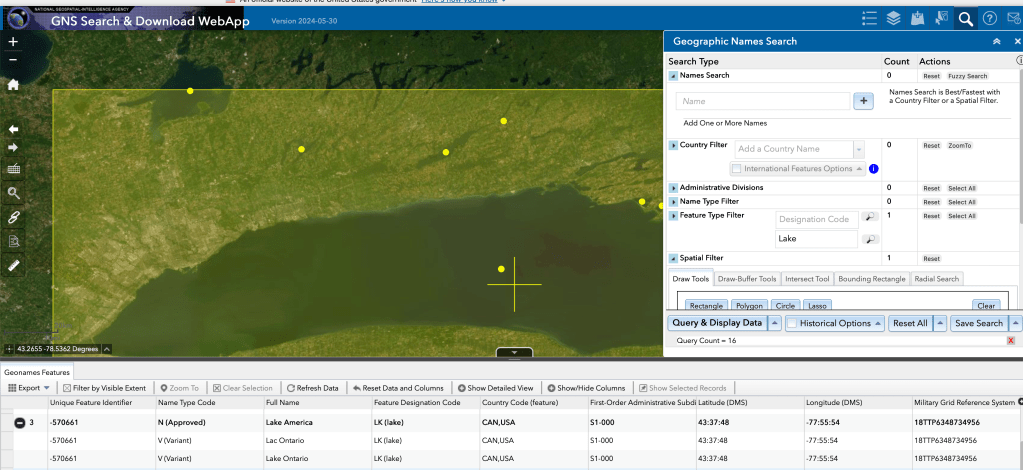
It has.
NGA also made a press release announcing the change.
THE BIG PICTURE
Changing a label on a map is minor compared to broader policy decisions, but it represents something dangerous.
Trump and his administration are using the machinery of the state to turn a political assertion into official, authoritative government data.
The issue isn’t just that a name changed.
It’s the willingness to politicize foundational datasets that are supposed to reflect geographic reality, simply to serve its political messaging.
It’s one thing for a politician to lie on the campaign trail. It’s another when the President signs an Executive Order mandating that a lie becomes the official policy of the United States of America.
When we can’t rely on data from the US Government to be accurate, factual, and authoritative, we’ve lost something much more precious than just names on a map.
Today, it is a boundary line or a lake name.
Tomorrow, it is government data on public health, election results, climate science, or international conflicts.
Officially calling it Lake America is just a signal of a far deeper issue.


You must be logged in to post a comment.